What is Clustering
Unsupervised learning
Requires data, but no labels
labelled data is the ‘ground truth’
supervised learning aim to model the relationship in data (i.e., data-driven) and eventually help to predict, thus need the ‘ground truth’.
Focus on detecting patterns e.g. in
Group emails or search results
Customer shopping patterns
Regions of images
Geospatial Point Patterns
Useful when don’t know what you’re looking for
Useful when you’re not sure what patterns or groups exist in your data.
However, you may remain don’t know what you’re looking at
You may still need to interpret and analyze the resulting clusters to understand their meaning and significance.
Basic idea of clustering
Identifying breeds of dogs
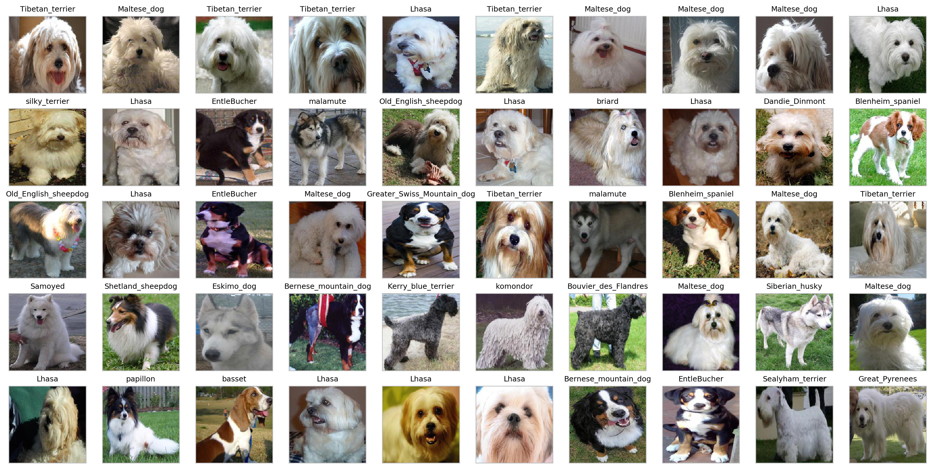
Identify dogs that look similar from the photos. Source: Solving the mystery of my dog’s breed with ML
Identifying individual pet

Looking for the same person or pet in the photo gallery. Image Source: iOS 17 Photos App Recognizes Your Pets
Group together similar/near instances
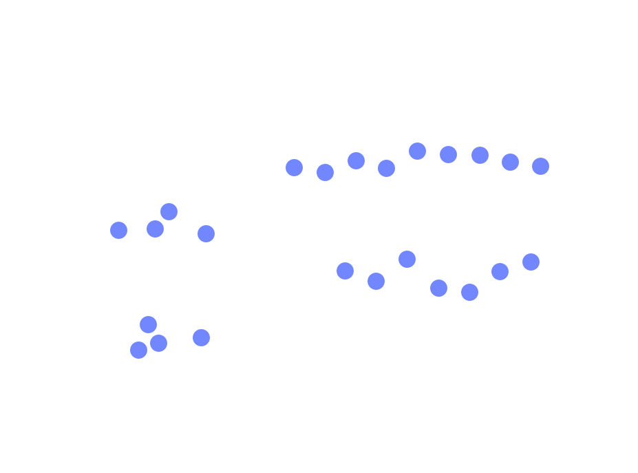
The data points.
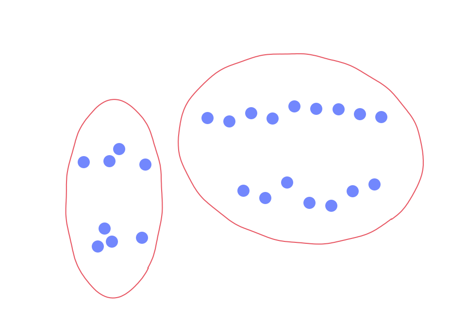
2 big groups.
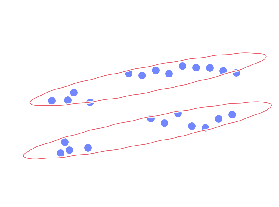
Another 2 big groups.
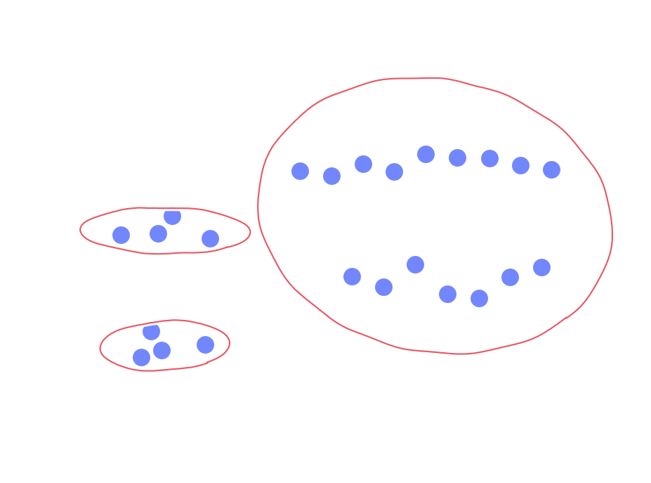
Those on the left split into 2 small groups.

Those on the right split into 2 small groups.
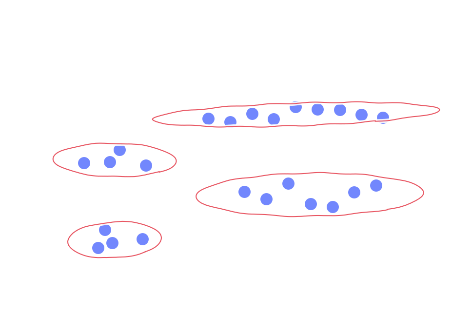
4 small groups.
What could ‘similar’ or ‘near’ mean?
The two distances assume the value ranges are equal (similar) among dimensions. (Equal aspect)
How to measure similarity/dissimilarity?
Euclidean distance
Manhattan distance
Other ways to define ‘distance’ between data points (instances)
More than 2 dimensions
The clustering results are highly dependent on the similarity metric (or distance measure) chosen to evaluate the proximity between data points within the cluster analysis.
What is spatial clustering?
].column[
On Spatial Point Patterns: The 2 dimensions are X and Y
On Attribute-based Spatial Clustering: The clustering is run on some attributes fields rather than its X & Y locations
What is spatial clustering?
On Spatial Point Patterns
Animal habitats: Analyze GPS data from animal tracking devices to identify clusters of locations where animals spend most of their time. This can help researchers better understand habitat preferences and territorial behaviors.
Activity spaces: Analyze GPS data from human participants or mobile devices to cluster locations where individuals spend significant amounts of time, such as home, work, or recreational areas. This can help urban planners and researchers understand human movement patterns and inform the design of more efficient and livable urban spaces.
Traffic accidents: Cluster the locations of traffic accidents in a city based on their spatial coordinates to identify accident hotspots. This information can be used to improve road safety and inform infrastructure planning.
Crime hotspots: Cluster crime incidents based on their geographical locations to identify areas with high concentrations of criminal activity. This information can be used by law enforcement agencies to allocate resources more effectively, develop targeted crime prevention strategies, and improve public safety.
Cell tower coverage: Group cell towers based on their spatial distribution to determine regions with optimal coverage and identify areas where additional towers may be needed to improve network performance.
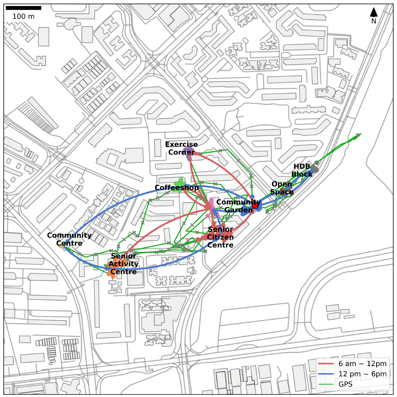
Using the GPS records of a person moving within a neighborhood to detect clusters (with noises) and identify the place where the participant had visited by follow-up interview and manual checking. Feng et al. 2024.
On Attribute-based Spatial Clustering
Real estate analysis: Use attributes such as property value, lot size, and property age to cluster homes in a neighborhood. This can help real estate agents and potential buyers identify areas with similar property characteristics.
Environmental monitoring: Cluster air quality monitoring stations based on attributes like pollutant concentrations, temperature, and humidity. This can help identify areas with similar air quality profiles and inform pollution control strategies.
Demographic analysis: Group census tracts or neighborhoods based on attributes such as population density, age distribution, and income levels to identify areas with similar demographics. This information can be valuable for urban planning, social services, and targeted marketing.
Urban function analysis: Cluster POIs within a city based on their types (e.g., retail, entertainment, healthcare, education) to identify areas with distinct urban functions and land use patterns. This can help urban planners and decision-makers better understand the distribution of various amenities and services within the city and inform urban development strategies.
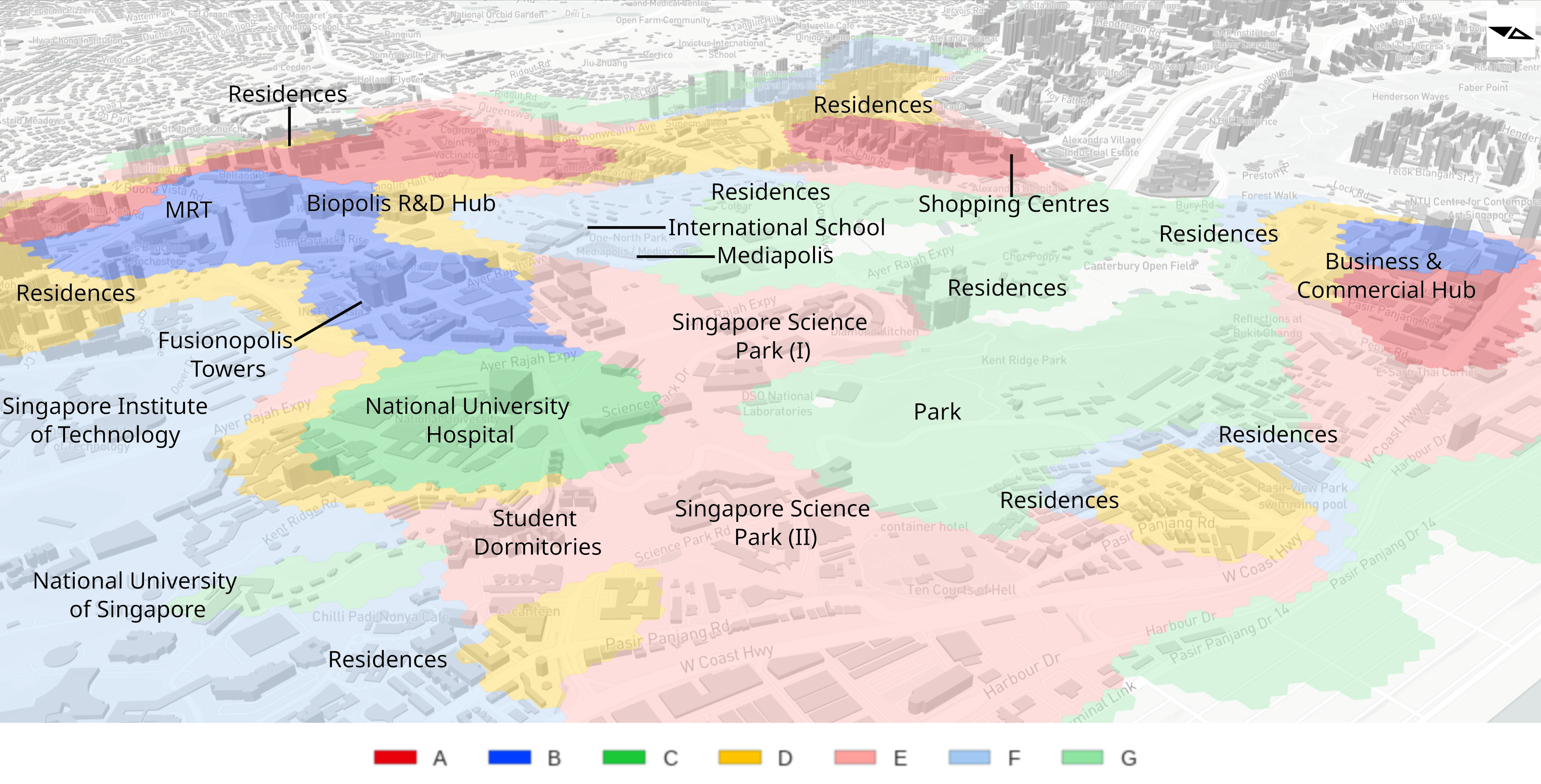
The study run clustering on the kernel density of various GPS types and identify clusters with similar density of the different POI types. Chin et al. 2023
Types of clustering methods
Partitioning:
Central Tendency: focus on the ‘center’ of the clusters, e.g., k-means, k-medoids
Density-based: focus on the ‘density’ of the data points, e.g., DBSCAN
Hierarchical Clustering:
Agglomerative (bottom-up): Starts with each point as a separate cluster, then merges pairs of clusters until all points are in a single cluster.
Divisive (top-down): Starts with all points in one cluster and recursively splits clusters until each point is in its own cluster.
- Feng, C., Chin, W. C. B., Gao, S., Chua, V., & Ho, E. L. (2024). Illustrating a Splatial Framework to Aging: Absolute, Relative, Relational, and Mental Space in Singapore. Transactions in GIS, 28(7), 2281–2294. 10.1111/tgis.13235