Paper
Srikanth, A. D. S., Chin, W. C. B., Bouffanais, R., Schroepfer, T. (2022) Complexity science-based spatial performance analyses of UNStudio/DP Architects’ SUTD Campus and WOHA's Kampung Admiralty. In As, I., Basu, P. and Talwar, P. (eds.) Artificial Intelligence in Urban Planning and Design: Technologies, Implementation, and Impacts. (pp. 39-58). Elsevier. ISBN:978-0-12-823941-4. DOI:10.1016/B978-0-12-823941-4.00019-6.
Abstract
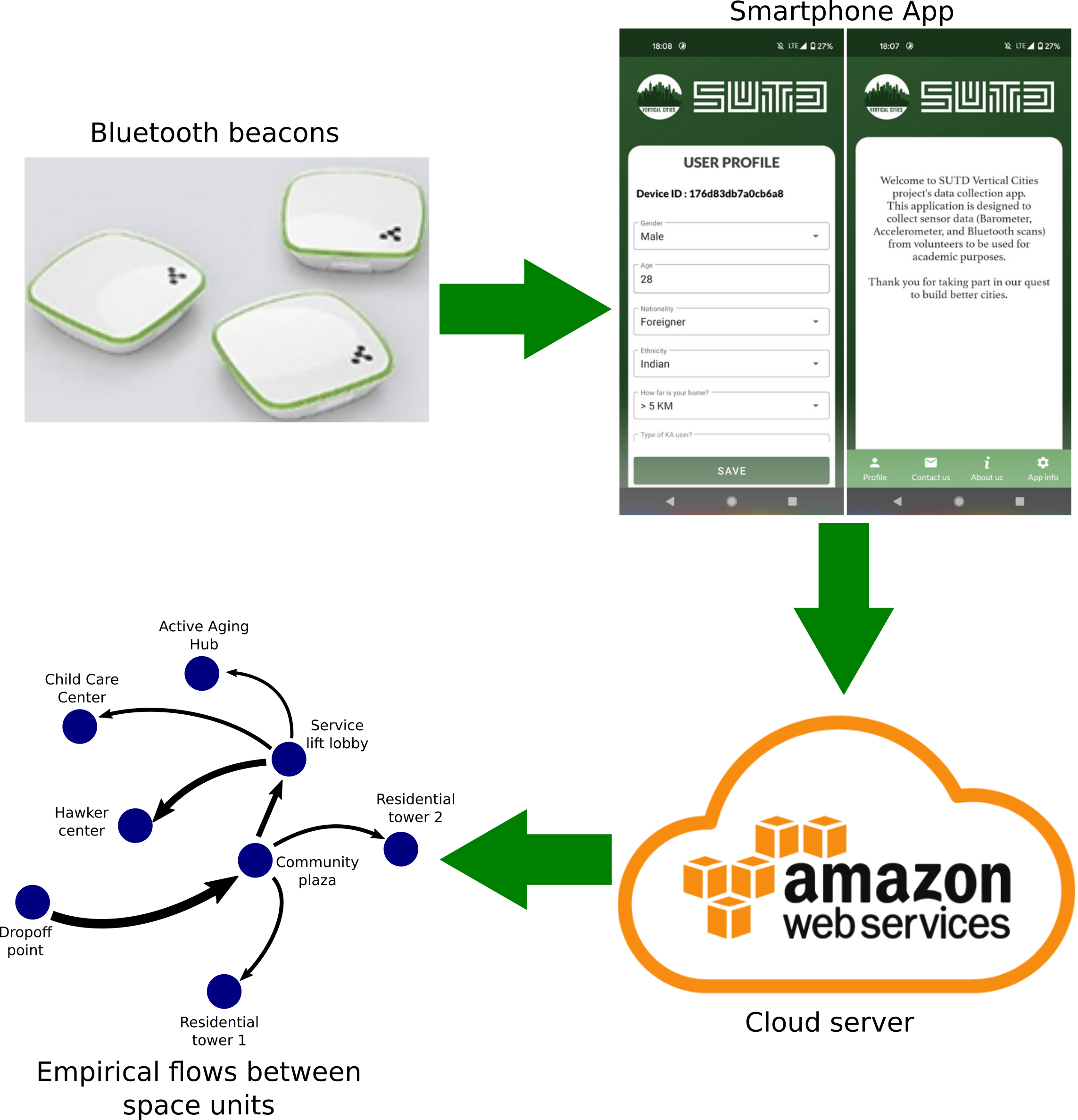
In this chapter, we describe a complexity science-based complex network methodology that employs machine learning to systemically analyze spaces in high-density urban-built environments in order to understand the efficacy of their use to inform future planning and design decisions. Our approach uses computational social science methods to interpret data collected on site with micro-mobility sensors that allow for the detection of spatial human activity patterns. We demonstrate our approach with two case studies in Singapore: Kampung Admiralty, a recently completed public high-density mixed-use development for the elderly population of the city state and the Singapore University of Technology and Design, a vertically integrated urban campus. Our approach provides a scientific methodology for the analysis of everyday space use. The methodology is scalable and can be applied to buildings as well as the larger urban context they are part of. By analyzing the performance of urban and architectural spaces in terms of their use, our approach can provide a scientific basis for measuring their success.
Read article here:
- Official website: Complexity science-based spatial performance analyses of UNStudio/DP Architects’ SUTD Campus and WOHA's Kampung Admiralty, Artificial Intelligence in Urban Planning and Design: Technologies, Implementation, and Impacts,
- ResearchGate: Abstract and full text (on request or downloadable directly),
- Please contact me (by Gmail ).